Kuro Siwo: 12.1 billion $m^2$ under the water. A global multi-temporal satellite dataset for rapid flood mapping
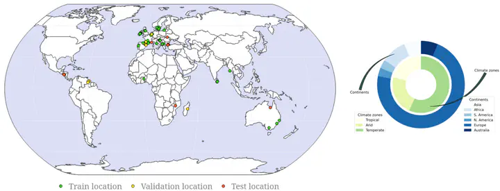 Spatial distribution of Kuro Siwo
Abstract
Global floods, exacerbated by climate change, pose severe threats to human life, infrastructure, and the environment. This urgency is highlighted by recent catastrophic events in Pakistan and New Zealand, underlining the critical need for precise flood mapping for guiding restoration efforts, understanding vulnerabilities, and preparing for future events. While Synthetic Aperture Radar (SAR) offers day-and-night, all-weather imaging capabilities, harnessing it for deep learning is hindered by the absence of a large annotated dataset. To bridge this gap, we introduce Kuro Siwo, a meticulously curated multi-temporal dataset, spanning 32 flood events globally. Our dataset maps more than 63 billion $m^2$ of land, with 12.1 billion of them being either a flooded area or a permanent water body. Kuro Siwo stands out for its unparalleled annotation quality to facilitate rapid flood mapping.
Comparison of Kuro Siwo annotations with pre-existing Copernicus Emergency Service (CEMS) flood mapping
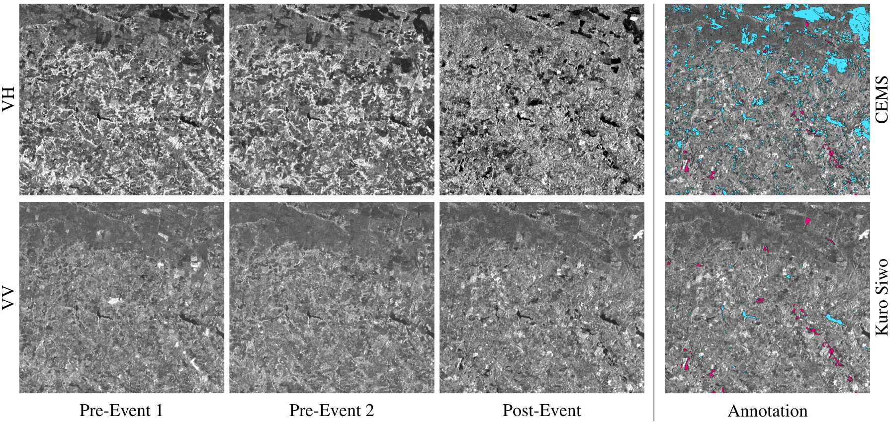 (left) Mosaic depicting Kuro Siwo samples for both VV and VH polarizations. (right) Copernicus Emergency Management
Service (CEMS) annotations for a 2020 flood event in an agricultural area in France vis `a vis Kuro Siwo photointerpretation. Cyan denotes permanent water bodies while purple indicates flooded areas. Notably, errors in CEMS annotations are apparent, particularly in the
Permanent Waters class, suggesting the possibility that the CEMS annotator solely used VH polarization for annotation in this particular
example.
(left) Mosaic depicting Kuro Siwo samples for both VV and VH polarizations. (right) Copernicus Emergency Management
Service (CEMS) annotations for a 2020 flood event in an agricultural area in France vis `a vis Kuro Siwo photointerpretation. Cyan denotes permanent water bodies while purple indicates flooded areas. Notably, errors in CEMS annotations are apparent, particularly in the
Permanent Waters class, suggesting the possibility that the CEMS annotator solely used VH polarization for annotation in this particular
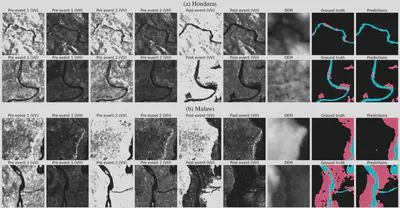
example.Qualitative evaluation of a model trained on Kuro Siwo
Nikolaos-Ioannis Bountos
PhD Candidate
Maria Sdraka
PhD Candidate
Earth Observation, Deep Learning, Natural Hazard Monitoring, Computer Vision
Angelos Zavras
PhD Candidate
Andreas Karavias
Earth Observation & GIS specialist
Themistocles Herekakis
Geo-ICT developer
Dimitrios Michail
Associate Professor @ HUA
Adjunct Researcher @ OrionLab
My research interests include Graph Algorithms, Graph Mining, Machine Learning, Algorithm Engineering.
Ioannis Papoutsis
Head of Orion Lab
Assistant Professor of Artificial Intelligence for Earth Observation @ NTUA
Adjunct Researcher @ NOA
Earth Observation, Machine Learning, Natural Hazard Monitoring